OUR ACTIVITIES
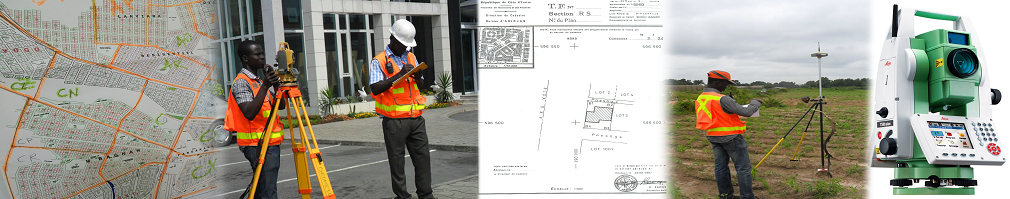
GEOMATIC
Geomatic is all the technical acquisition, integration, management and exploitation of geographic information.
In this context, the surveyor assists its clients in the implementation, operation and maintenance of a geographic information system (GIS).
ESTABLISHMENT OF A GEOGRAPHIC INFORMATION SYSTEM (GIS)
The SIG is a software tool for decision support enabling local authorities to optimize the management of heritage (duration of concessions in cemeteries, public lighting management, etc.):
- querying the map data with spatial queries,
- valuing these data by multi-criteria queries,
- produce thematic maps.
The surveyor, with his mastery of mapping technologies in the areas of land and land is then in charge of production and integration of map data.